Species
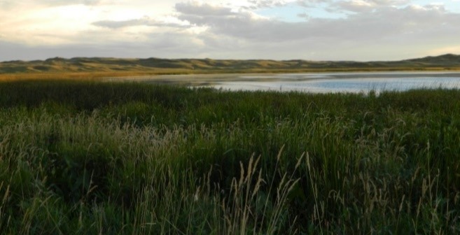
Sandhills Wetland/ Wet Meadow Habitat
Principal biologist(s)
Carter Kruse, Eric Leinonen
Project Location
Gordon Creek, Headquarters Meadow, McMurtry Ranch, NE
Tennessee Valley, Sandy Richards Creek, Four Corners Lake, Fawn Lake Ranch, NE
Snake River, Deer Creek Ranch, NE
Capp Valley, Spikebox Ranch, NE
Project Partners
US Fish and Wildlife Service
Nebraska Game and Parks
Sandhills Task Force
Natural Resources Conservation Service
Conservation Problem
Loss of Sandhills wet meadow and wetland habitat due to ditching and draining for hay and grazing production. As much as 40% of Sandhills wetlands lost due to agricultural development.
Project Goals
We aim to restore the natural hydrology and fen, wetland, and wet meadow habitats and their associated native plant communities in impacted valley bottoms on Turner Sandhills ranches. We also aim to contribute information on Sandhills fen restoration to the scientific community to improve our understanding of these habitats and opportunities for restoration.
Project Background
The Nebraska Sandhills cover some 12.75 million acres of the Central Mixed Grass Prairie ecosystem. The six Turner Ranches in the Sandhills comprise 3.2% of the region. The Sandhills prairies are a vast area of grass covered sand dunes interspersed with interdunal depressions and valley bottoms. Many valley bottoms intersect relatively shallow groundwater gradients, resulting in “wet meadow” habitats that are productive moist grasslands, fens, wetlands, or lakes and ponds supporting a wide diversity of plant and animal species. The area is the second most productive waterfowl region in North America. Streams originating in the Sandhills are unique in their mostly groundwater origins, lack of tributary network, and flow stability, as surface precipitation readily percolates into the sand and shallow groundwater system. Approximately 66% of the recharge for the Ogallala aquifer occurs in the Sandhills. The Sandhills region is relatively unimpacted overall and represents perhaps the most intact grassland system remaining in world.
Productive wet meadow habitat in the Sandhills are often intensively managed for grazing and haying. A common management practice is development of drainage ditches that remove surface water and/or lower the shallow subsurface water table to improve access for livestock and machinery. Although the Sandhills are relatively intact overall, wet meadow and wetland habitats in the region have been disproportionately impacted for production purposes. Fens, which are special groundwater-fed, peat-filled wetlands, are often associated with shallow groundwater areas at the head of stream valleys or upper ends of wet meadows and wetlands. Great Plains fens often support diverse and regionally unique (glacial relict) flora. Sensitive or rare plants associated with wet meadows and fens include prairie white fringed orchid (federally and state listed threatened species) tall cotton-grass, bog bean, marsh marigold, spike muhly, and bog aster. Because of ditching and draining, which can lower groundwater levels and ultimately change the hydrology of wetland and fen habitats (leading to decomposition of peat and invasion by non-native species), Sandhills fens, and the communities associated with them, continue to decline in extent and condition. Generally, fen habitat is considered critically imperiled.
Project Background
Sandhills Ranch managers and TBD biologists recognize both the negative ecological impacts and positive production benefits of existing drainage ditches found on some of the Turner Sandhills ranches. Significant consideration has been given to where TBD, working with project partners, can restore fen and wetland habitats without significantly impacting production goals.
The Gordon Creek project was the first, and to-date only, meadow restoration project completed on Turner Sandhills ranches. This project, completed in 2015, restored approximately 3 miles of impaired creek channel and over 400 acres of wet meadow and wetland habitat. It is the largest stream restoration project ever completed in the Sandhills.
In 2017, TBD visited other priority restoration areas with project partners and potential contractors, and it was agreed that Capp Valley, a relatively straightforward ditch-fill project, would be the next project implemented. A topographic survey of the project area necessary for design criteria was completed by NRCS in 2017.
Project Activities in 2018
A project design for the Capp Valley project was completed by NRCS in early 2018. Northern Underground of Sheridan, WY submitted a $55,700 bid for the project. A required wetland delineation was completed and 404/401 permit applications were drafted. These federal and state certifications, respectively, are necessary to dredge and fill in wetland habitats. The project was scheduled for implementation in late summer 2018 but delayed due to permitting and funding issues.
